From Creative Commons
I didn’t go up to Rogers City. So I missed (1) the monthly business meeting of my Zonta chapter, (2) the monthly meeting of the Rogers City City Council ad hoc Growth Committee of which I am a member, and (3) monthly meeting of the Presque Isle County Fair Board of which I serve.
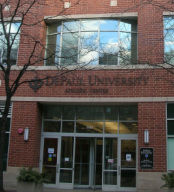
Instead I went to the Rules Committee of the Chicago City Council’s ward remap public hearing held at the student center at DePaul University. I sat with my friend Anna Klocek. We met when we both ran for alderman in 2007. I ran in the 43rd ward and she ran in the 45th ward. She also ran in 2011.
The room was filled to capacity, over 500 people before it began at 6:00 P.M. Some people couldn’t get in and had to wait for people to leave in order to get a seat. Alderman Richard "Dick" Mell, Chair of the Rules Committee, presided and was joined on the dias by about twenty alderman.
There were people from all over the city although lots of the early speakers were from the 43rd ward and 32nd ward. DePaul’s Lincoln Park campus is currently split into two wards. Ten years ago it was in one ward. And under one of the proposed maps, it could wind up being in three wards. That would probably make planning and zoning changes more cumbersome.
Easels held blow-ups of the three maps that were then being considered by the Rules Committee and thus the entire City Council. No one in the audience liked any of them. Some comments were very funny (“My new ward boundary goes west on Belmont, then south on Ashland and ends in a cornfield in Iowa!”) and others were very pointed including one speaker volunteering to be the first plaintiff in a lawsuit challenging the maps.
Participants raised various arguments of the probably unconstitutionality of the proposed maps. In my comment I suggested the number of aldermen be reduced to reflect the reduction in population. I opposed the map that would cut the 43rd Ward into three separate wards.
Its not clear whether the Committee has used the services of a mapping firm to create any of the maps. It just seems to me that if you pumped the demographic data into a computer, told it where the historic neighborhood boundaries are and the geographical boundaries of the various neighborhood organizations the computer could spit out a better map than this process of backroom negotiations.
The City Council could possibly vote on this on January 18. It is hard to figure what the hurry is to make a rash decision that could lead to a referendum or lawsuits or both. The new map won’t be used until the next Aldermanic election which will occur in 2015, unless the world ends in 2012.
The meeting ended around 10:30. Anna and I went to Webster Wine Bar and shared a wonderful arugula pizza.
 RSS Feed